Property Record
4251 Hamilton Mill Rd, Buford, GA 30519


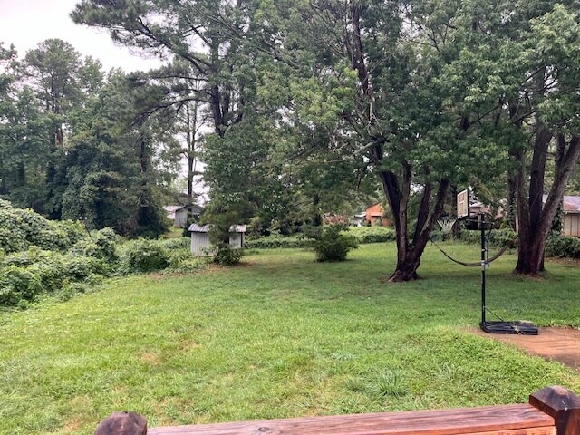
Property Detail
4251 Hamilton Mill Rd
Atlanta-Sandy Springs-Roswell, GA
Van Berry
7-262-015
LOT 9 BERRY S/D
Sfr
Gwinnett
X
Georgia
13135C0016G
262
2025
0.58 AC
2025
Duluth/Suwanee/Buford
050105
Atlanta
1,972 SF
NEARBY LISTINGS FOR SALE OR LEASE
DEMOGRAPHICS near 4251 Hamilton Mill Rd
1 mile
3 mile
5 mile
2024 Total Population
4,434
47,387
128,849
2029 Population
4,611
50,625
137,733
Pop Growth 2024-2029
+ 3.99%
+ 6.83%
+ 6.89%
Average Age
37
38
38
2024 Total Households
1,307
15,583
42,806
HH Growth 2024-2029
+ 4.13%
+ 6.99%
+ 7.11%
Median Household Inc
$88,295
$74,571
$86,616
Avg Household Size
3.30
3.00
3.00
2024 Avg HH Vehicles
2.00
2.00
2.00
Median Home Value
$340,956
$348,179
$333,285
Median Year Built
1997
2003
2002
Nearby Places
Map Layers
Map Styles
 Street
 Aerial
Transit
 Traffic
 Biking
Places
Listings with unknown addresses are not visible on the map
- Restaurants
- Banks
- Shops
- Fitness
- Groceries
PUBLIC TRANSPORTATION
AIRPORT
Hartsfield - Jackson Atlanta International
Drive
Walk
Distance
Hartsfield - Jackson Atlanta International
62 min
47.8 mi
SALE & LEASE HISTORY
LISTING DATE
SALE/LEASE

Jul 24, 2024
For Sale
Nearby Properties
Address
Land Use
TOTAL SIZE
Lot Size
Zoning
Address
Land Use
TOTAL SIZE
Lot Size
Zoning
1,435,842 SF
83.47 AC
C2
Address
Land Use
TOTAL SIZE
Lot Size
Zoning
815,563 SF
58.80 AC
M-I
Address
Land Use
TOTAL SIZE
Lot Size
Zoning
101,632 SF
78.33 AC
M-I
Address
Land Use
TOTAL SIZE
Lot Size
Zoning
684,003 SF
60.84 AC
M1
Address
Land Use
TOTAL SIZE
Lot Size
Zoning
286,520 SF
21.60 AC
P
Address
Land Use
TOTAL SIZE
Lot Size
Zoning
384,000 SF
23.08 AC
BG
Address
Land Use
TOTAL SIZE
Lot Size
Zoning
521,231 SF
46.16 AC
HM1
Address
Land Use
TOTAL SIZE
Lot Size
Zoning
335,438 SF
10.94 AC
MUR
Address
Land Use
TOTAL SIZE
Lot Size
Zoning
461,700 SF
43.77 AC
C2
Address
Land Use
TOTAL SIZE
Lot Size
Zoning
121,100 SF
3.74 AC
RM24
Address
Land Use
TOTAL SIZE
Lot Size
Zoning
323,877 SF
29.14 AC
C2
Address
Land Use
TOTAL SIZE
Lot Size
Zoning
144,000 SF
21.13 AC
RM
Address
Land Use
TOTAL SIZE
Lot Size
Zoning
204,436 SF
16.28 AC
BG2
Address
Land Use
TOTAL SIZE
Lot Size
Zoning
496,608 SF
29.68 AC
C2
Address
Land Use
TOTAL SIZE
Lot Size
Zoning
652,710 SF
40.90 AC
M1
Address
Land Use
TOTAL SIZE
Lot Size
Zoning
440,904 SF
37.84 AC
M1
Address
Land Use
TOTAL SIZE
Lot Size
Zoning
264,600 SF
10.27 AC
M1
Address
Land Use
TOTAL SIZE
Lot Size
Zoning
150,591 SF
24.39 AC
P
Address
Land Use
TOTAL SIZE
Lot Size
Zoning
641,180 SF
57.04 AC
M1
Address
Land Use
TOTAL SIZE
Lot Size
Zoning
353,241 SF
33.16 AC
C2
Address
Land Use
TOTAL SIZE
Lot Size
Zoning
875,180 SF
58.69 AC
C1
Address
Land Use
TOTAL SIZE
Lot Size
Zoning
280,168 SF
29.08 AC
M1
Address
Land Use
TOTAL SIZE
Lot Size
Zoning
573,750 SF
43.94 AC
C1
Address
Land Use
TOTAL SIZE
Lot Size
Zoning
274,018 SF
25.57 AC
M1
Address
Land Use
TOTAL SIZE
Lot Size
Zoning
544,900 SF
46.95 AC
M1
Address
Land Use
TOTAL SIZE
Lot Size
Zoning
72,304 SF
83.10 AC
R100
Address
Land Use
TOTAL SIZE
Lot Size
Zoning
506,870 SF
21.60 AC
M1
Address
Land Use
TOTAL SIZE
Lot Size
Zoning
488,890 SF
59.62 AC
M1
Address
Land Use
TOTAL SIZE
Lot Size
Zoning
225,851 SF
34.35 AC
R75
Address
Land Use
TOTAL SIZE
Lot Size
Zoning
262,793 SF
38.09 AC
M1
The World's #1 Commercial Real Estate Marketplace
Connect with us
© 2026 CoStar Group
The information above has been obtained from sources believed reliable. While we do not doubt its accuracy we have not verified it and make no guarantee, warranty or representation about it. It is your responsibility to independently confirm its accuracy and completeness. Any projections, opinions, assumptions, or estimates used are for example only and do not represent the current or future performance of the property. The value of this transaction to you depends on tax and other factors which should be evaluated by your tax, financial, and legal advisors. You and your advisors should conduct a careful, independent investigation of the property to determine to your satisfaction the suitability of the property for your needs.